Source: University Endowment Lands Area D / Neighbourhood Profile / September, 2018
Pre 1910:
For thousands of years the xwmәθkwәýәm Musqueam First Nation carried out fishing, hunting, trapping and spiritual activities on the Point Grey Peninsula, which is part of their Core Territory.
1860 - 1873:
Western tip of Point Grey established as a Colonial Admiralty Reserve, under ownership of the Government of Canada (likely to protect the entrance to English Bay).
1907:
University Endowment Act established a lands trust to raise capital for the formation and initial operation of the University of British Columbia.
1910:
The site of what would become UBC was chosen in 1910.
1911:
Province passes legislation to establish UBC and enacts the University Site Act, which sets aside 71 ha in Point Grey for the University.
1912:
The Colonial Admiralty Reserve is transferred to the provincial government and becomes provincial Crown land.
1920:
The Province passes the University Loan Act, which allows the Province to develop and dispose of 1200 ha of land on the Point Grey Peninsula primarily for residential purposes, with the proceeds going to UBC.
1925:
The first residential lots were sold by public auction in 1925.
1925:
The Province passes the University Endowment Lands Administration Act to provide administration of local services to the developing community. This later becomes the University Endowment Lands Act, which remains the governing legislation today.
1927:
The first residential buildings were completed in Area D.
1929:
The municipalities of South Vancouver and Point Grey merge with the City of Vancouver, but this merger does not encompass the UEL and sets the eastern boundary of the UEL that exists today.
1930s:
Residential development slowed to the point that the University could not afford to undertake land development and returns control of the land to the Province.
1947-1952:
Somerset Manor and the Colonial are the first four-storey apartments constructed in the UEL.
1965:
The Province enacts legislation to create regional districts for nearly all of BC. The Greater Vancouver Regional District (now Metro Vancouver) is formed and the UEL becomes part of Electoral Area A which now includes the UEL, UBC, Barnston Island, and other unincorporated communities.
1972:
Chancellor Court, the first modern concrete high-rises in UEL, are built.
1989:
The Province establishes Pacific Spirit Regional Park under a tenure that stipulates the land can only be used for park purposes.
1993:
A large fire in the University Village destroys several businesses.
1995:
A vote is held on incorporating the UEL and Hampton Place, one of the now University Neighbourhood Association (UNA) areas, as a municipality; it was unsuccessful.
1998:
Rezoning of University Marketplace was approved in January.
2001:
Cornelia Oberlander redesigns Jim Everett Park.
2005:
UEL Official Community Plan adopted after extensive consultation process.
2001-2007:
The first strata condos and townhomes begin to be built in the UEL.
2008:
The Musqueam Reconciliation Settlement and Benefits Agreement transfers ownership of three blocks of land within the UEL to the Musqueam First Nation: Block F; Block K; and the University Golf Course.
2016:
Rezoning of Block F was approved in November.
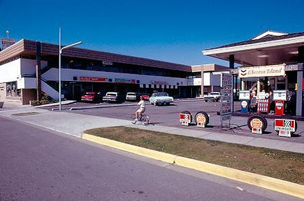
Source: UBC Archive Photo Collection

Dated to January 1st, 1969.

Dated to between 1930 and 1939.

Dated to January 1st, 1969.

Dated to between 1960 and 1969.